History of Dakshina Kannada District

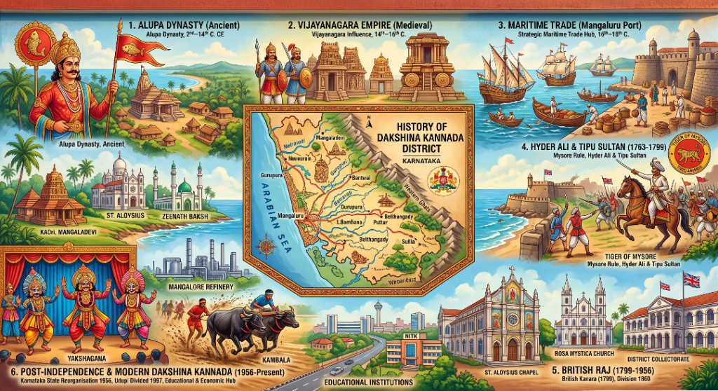
Dakshina Kannada, historically known as South Canara, has a rich and diverse history shaped by ancient dynasties, maritime trade, cultural traditions, and religious heritage. The region was ruled by the Alupa dynasty for several centuries and later came under the influence of the Vijayanagara Empire. Its strategic location along the Arabian Sea made Mangaluru an important centre for maritime trade, attracting Portuguese and other foreign traders. In 1763, Hyder Ali conquered Mangaluru, and the region subsequently became part of the Mysore Kingdom under Tipu Sultan. Following the fall of Tipu Sultan in 1799, the British took control and Mangaluru became the headquarters of the Kanara region. In 1860, Kanara was divided into North Kanara and South Kanara. After the States Reorganisation in 1956, South Kanara became part of Mysore State, later renamed Karnataka. In 1997, the district was divided and Udupi district was formed, while Mangaluru remained the headquarters of Dakshina Kannada.
About Dakshina Kannada
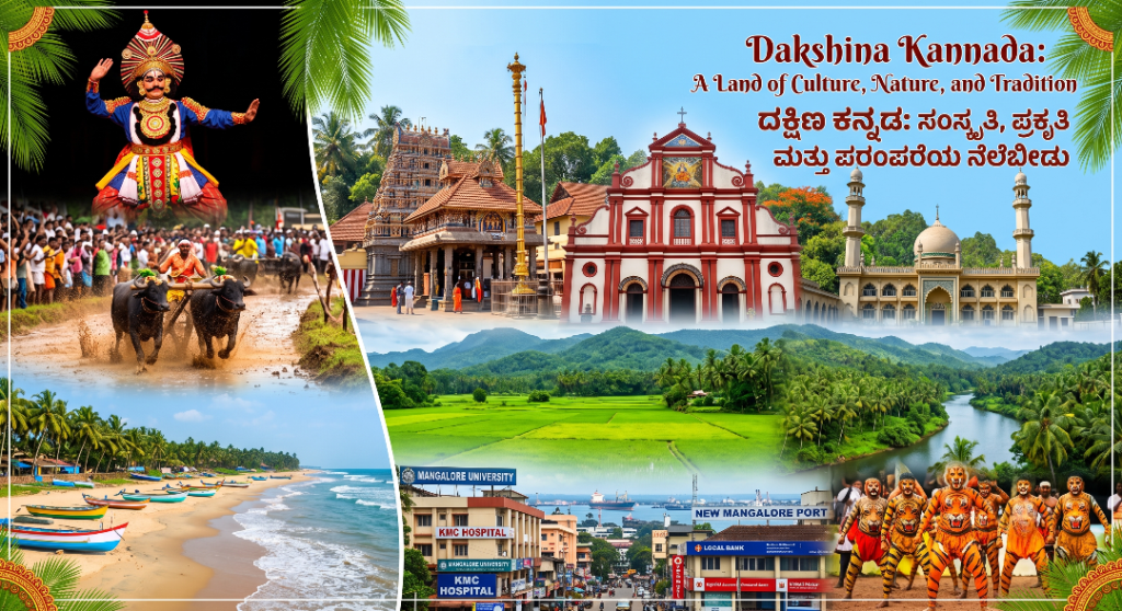
Dakshina Kannada is a prominent coastal district in the state of Karnataka, located in the southwestern part of India. The district headquarters is Mangaluru, a major coastal city known for its port, educational institutions, healthcare facilities, banking sector, trade and tourism. Dakshina Kannada is geographically distinctive, extending from the Arabian Sea in the west towards the Western Ghats in the east. The district is known for its beautiful beaches, rivers, forests, agricultural landscapes, temples, churches, mosques and traditional cultural practices. The region has a rich cultural identity influenced by communities speaking Kannada, Tulu, Konkani and Beary, among other languages. Traditional art forms such as Yakshagana and Bhoota Kola, along with the traditional sport of Kambala, form an important part of the district’s heritage.
Dakshina Kannada Districts
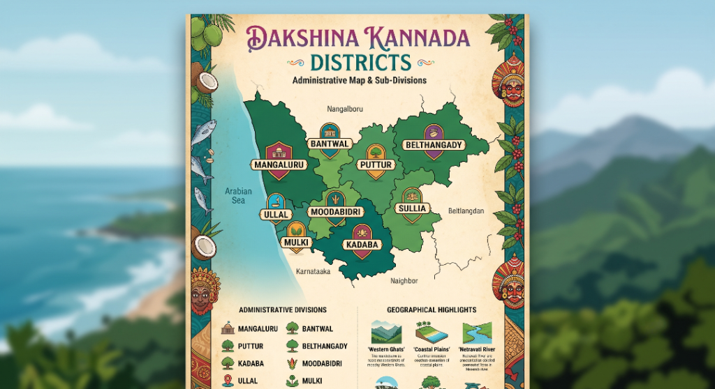
The infographic serves as an artistic tourism and educational visual, celebrating the unique identity of the Tulunadu region through traditional cartography and regional iconography. Styled like an archival travel poster, the parchment-textured layout effectively balances administrative clarity with local heritage. The vibrant vertical borders act as visual storytelling elements, capturing the lifeblood of coastal Karnataka—from the maritime economy represented by mackerel and coconuts to the indigenous theatrical art of Yakshagana and the dense plantation agriculture of the hinterlands. The central territorial breakdown visually demonstrates the shift from bustling port centers along the coastline to the forested foothills of the Western Ghats. Coastal urban hubs like Mangaluru, Ullal, and Mulki sit directly on the western boundary facing the Arabian Sea, while interior agricultural and pilgrim hubs like Puttur, Belthangady, and Sullia extend toward the interior ridges.
Population Profile
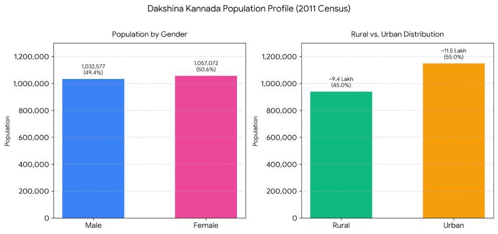
According to the 2011 Census, Dakshina Kannada district had a total population of approximately 20.89 lakh (2,089,649), comprising 10,32,577 males and 10,57,072 females. The district has a relatively high level of urbanization, with approximately 11.5 lakh people living in urban areas and around 9.4 lakh in rural areas. Mangaluru and other growing urban centres contribute significantly to the district’s urban population, while rural communities continue to play an important role in agriculture, traditional occupations, and the cultural life of the region. The population profile reflects the district’s diverse social structure and its position as an important urban, educational, commercial, and cultural centre of coastal Karnataka.
Statistics
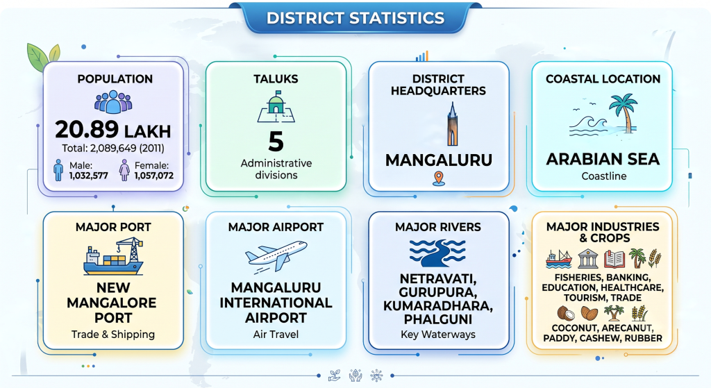
Dakshina Kannada stands as one of Karnataka’s most dynamic coastal districts, blending administrative efficiency, robust infrastructure, and cultural heritage. Governed from its headquarters in the port city of Mangaluru, the district is structured into five administrative taluks that cater to a thriving population of approximately 20.89 lakh residents. Geographically flanked by the Arabian Sea along its western edge, the region thrives on a maritime identity supported by lifelines such as the Netravati, Gurupura, Kumaradhara, and Phalguni rivers, which nourish its fertile rural hinterlands rich in coconut, arecanut, cashew, paddy, and rubber plantations. Complementing its agricultural and natural assets is an advanced trade and transit network that establishes Dakshina Kannada as a global gateway. The district hosts the New Mangalore Port, an all-weather deep-water port driving substantial maritime commerce, as well as the Mangaluru International Airport, which provides direct regional and international air connectivity.
Geographical Area
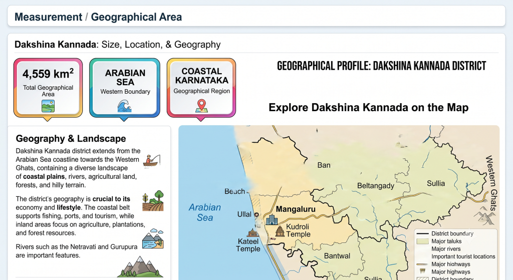
Dakshina Kannada is a prominent coastal district of Karnataka, covering a geographical area of approximately 4,559 square kilometres. The district stretches from the Arabian Sea in the west towards the Western Ghats in the east, creating a diverse landscape of coastal plains, rivers, fertile agricultural areas, plantations, forests and hilly terrain. Its coastal location supports fishing, maritime activities, ports and tourism, while the inland regions are well known for agriculture, plantations and forest resources. Major rivers such as the Netravati and Gurupura add to the district’s geographical importance and support agriculture and local livelihoods. The combination of coastline, river systems, fertile lands and Western Ghats makes Dakshina Kannada a region of significant ecological, economic and cultural importance.
Revenue and Economy of Dakshina Kannada
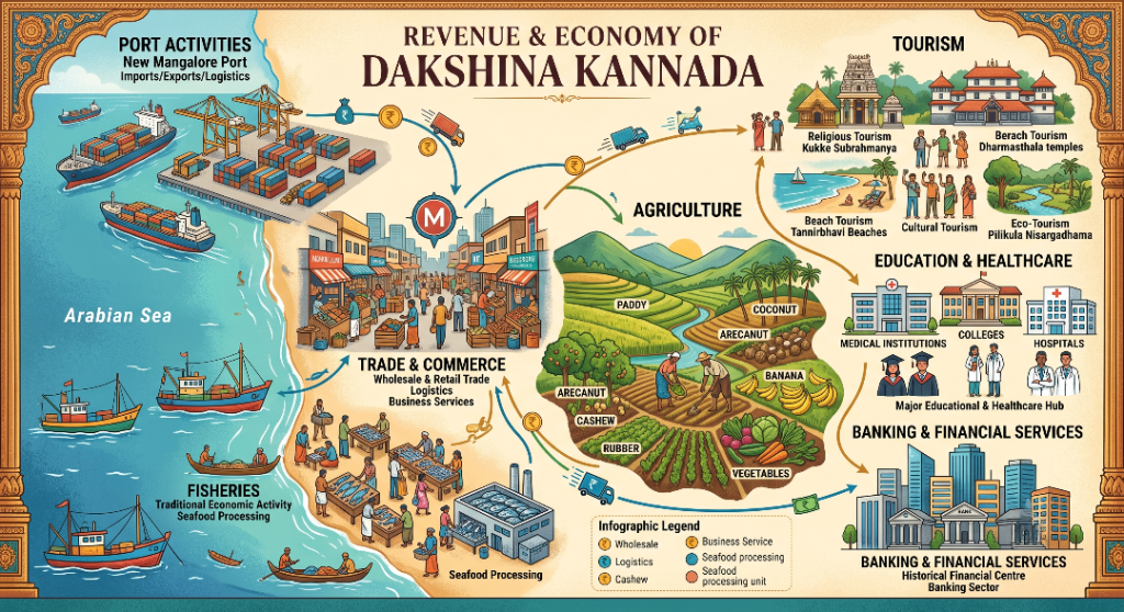
Dakshina Kannada district has a diverse and vibrant economy supported by trade and commerce, banking and financial services, education, healthcare, agriculture, fisheries, tourism, transportation, port activities, manufacturing and other service sectors. Mangaluru, the district headquarters, is the major commercial and economic centre of the region, supported by the New Mangalore Port and Mangaluru International Airport. Agriculture and plantation activities are important in rural areas, with crops such as paddy, coconut, arecanut, cashew, rubber, banana and vegetables contributing to local livelihoods. The district’s Arabian Sea coastline supports fishing, seafood processing and related industries, while its temples, beaches, cultural attractions and eco-tourism destinations contribute to the tourism economy.